

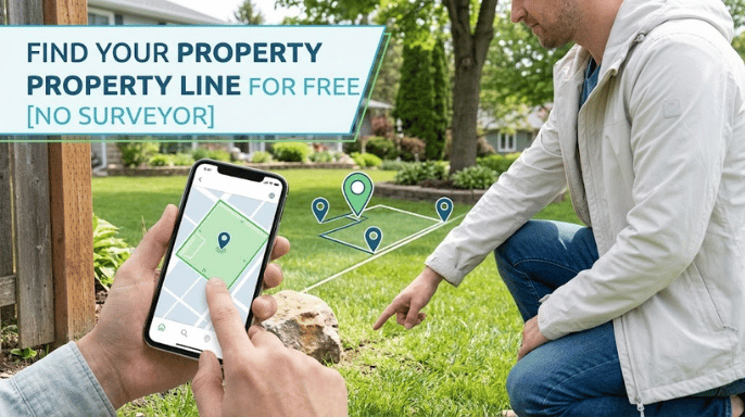
Your neighbor just planted a row of arborvitae, and you are fairly sure two of them are on your side. That question has a free answer, or at least most of one. Learning how to find your property line for free takes an afternoon, a county website, and a shovel.
Short version: pull your parcel on the county assessor’s mapping site, then download the recorded plat and the legal description off your deed. Measure from a fixed point and sweep for the buried iron pins with a metal detector. That usually gets you within a foot. A recorded survey is what settles an argument.
| Free method | Where it lives | What it really proves | Typical error |
| County GIS parcel viewer | Assessor or GIS office website | The shape and rough position of your lot | 5 to 30 feet |
| Recorded plat | County recorder or clerk | The platted bearings and distances of every lot line | Exact on paper |
| Deed legal description | Your closing packet or the recorder | The written legal boundary of your land | Exact on paper |
| Iron pins in the ground | Buried at each corner of your yard | Where a licensed surveyor actually set the corner | Inches |
| Parcel apps on your phone | App store, free tier or trial | The same county data on a moving map | 16 feet or worse |
| Aerial and topographic imagery | USGS National Map, county GIS | Old fences, tree lines and driveways over time | Feet to tens of feet |
| BLM General Land Office records | glorecords.blm.gov | Original federal survey plats and land patents | Historical |
Key Takeaways
Five things worth knowing before you spend a Saturday on this.
- Your county’s free parcel viewer is an assessor tax map, not a survey, and the county says so in its own metadata.
- The recorded plat and your deed’s legal description are the free documents that carry actual legal weight.
- Corner pins usually sit 6 to 10 inches down. A borrowed metal detector finds most of them.
- Phone GPS lands you inside a 16-foot circle, which is nowhere near good enough for a fence post.
- A boundary survey runs roughly $300 to $900, and it is the only version a court will read.
What You’ll Need Before You Start

None of this costs money. It costs a Saturday and some patience with county websites, which vary wildly in quality from one state to the next.
- Your parcel number, printed on your property tax bill
- Your deed, plus any survey that came home in your closing packet
- A tape measure that reaches at least 100 feet
- A metal detector, borrowed or rented for about $20 a day
- One screwdriver, a soil probe, and a small shovel
- Marking flags or spray paint
Call 811 at least two business days before you put a shovel in the ground. The service is free, and it brings out crews who paint buried gas, power, and communication lines so you do not slice one open hunting for a pin. Utility locates are also when easements surface, which matters a lot if a fence is the plan. Our rundown on what a sewer inspection turns up covers the other buried line most homeowners forget about.
How to Find Your Property Line for Free, Step by Step
Work these in order. Each step feeds the next one, and skipping the paperwork to go straight to the metal detector is how people spend three hours digging in the wrong spot.
- Search your address on the county assessor’s parcel viewer. Nearly every US county publishes one for free. It draws your lot outline over an aerial photo and lists your parcel number, acreage, and deed reference.
- Pull the recorded plat from the county recorder’s online index. If your home sits in a subdivision, a plat exists. It shows lot numbers, bearings, distances, easements, and the surveyor who signed it.
- Read the legal description printed on your deed. Platted lots read as a lot and block reference. Rural land reads as metes and bounds, a walk around the boundary in compass bearings and distances.
- Mark the two corners most likely to still exist. Front corners near the street survive better than back corners that have been landscaped over twice.
- Measure from something fixed. A curb, a sidewalk joint, a driveway edge, or a neighbor’s found pin all work. Pull the tape along the direction the plat gives, not along the fence.
- Sweep a widening circle with the metal detector. Start at your measured guess and spiral outward. Probe any hit with the screwdriver before you dig, then dig small.
- Flag every corner you find and run a string between them. That string is your working line. Photograph it, and write down the distance from a permanent object so you can find it again next year.
Two found pins beat six digital methods. Once you have a real corner in your hand, everything on the plat starts to make sense.
What Those Free Maps Can and Cannot Prove
Here is the part the app pages skip. A county GIS parcel layer is an assessor’s tax map that somebody digitized so the county could bill the right owner. Tuolumne County, California publishes guidance that its parcel data is intended for use at a 1:250,000 scale. The county recommends that only legally recorded parcel maps be used for measurement or design work.
Parcel apps inherit that problem and add one of their own. They plot you with your phone’s GPS chip. GPS.gov, the official US government service for the Global Positioning System, reports that GPS-enabled smartphones are typically accurate to within a 16-foot radius under open sky. Accuracy gets worse near buildings and trees. Sixteen feet is wider than most side yards, and a $900 fence sitting a foot over the line is a $900 mistake.
The app makers agree, quietly. LandGlide’s own support pages state that its lines are not intended to represent surveyed property lines recently and are not recommended for legal purposes. Read that twice before you set a post.
Reading the Plat and the Legal Description
A plat is the free document that comes closest to a survey, because a licensed surveyor drew and sealed it. Bearings read like N 89 degrees 12 minutes E. Distances run in feet and hundredths of a foot, so 120.45 means 120 feet and about five and a half inches.
Your deed’s legal description is the wording that actually conveys the land. If the plat and the deed disagree, the deed usually wins, and that conflict is exactly the kind of thing worth catching before closing rather than after. Buyers looking at raw acreage should work through the same records early, which is why our checks before buying land in Florida put survey and title review ahead of price.
- Point of beginning: the corner the description starts and ends at
- Call: one bearing and distance, one leg of the boundary
- Monument: a physical object the description ties to, such as an iron rod or a road centerline
- Easement: someone else’s recorded right to cross or use part of your land
Digging for the Iron Pins
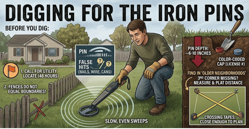
Blaine, Minnesota, publishes guidance putting its property markers roughly 6 to 10 inches below the surface, usually a metal pin under a colored plastic cap stamped with a license number. The city also asks residents to give the state utility locate service 48 hours before digging, and it warns that an existing fence cannot be used to verify a boundary.
Detectors get confused by nails, buried cans and old wire. Sweep slowly, mark every hit with a flag, and dig the shallowest one first. Rural corners are sometimes stone, a rebar stub, a pipe or a fence post set decades ago, so a hit that feels wrong may still be right.
Missing pins are common in older neighborhoods where utilities have been trenched. If two corners turn up and a third refuses to, measure the plat distance from both found corners and let the tapes cross. That intersection is close enough to plan around, though not close enough to build on. Before you commit to posts, it helps to know which fence styles and materials your setback rules even allow.
What a Real Survey Costs
Free gets you oriented. A licensed survey gets you certainty, and the price is lower than most people assume. These are 2026 US market ranges compiled by cost aggregator HomeGuide from contractor quotes, so treat them as a budgeting guide rather than a quote.
| Survey type | Typical cost | What you get |
| Boundary survey | $300 to $900 | Corners located and marked, plus a drawing of the lines |
| Fence or lot stakeout | $200 to $1,200 | Stakes set on the line where the fence will run |
| Mortgage or location survey | $200 to $700 | A simple sketch a lender will accept |
| One acre of rural land | $500 to $1,000 | Boundary work on unplatted ground |
| ALTA/NSPS survey | $1,200 to $4,000 | The full commercial standard, easements and encroachments included |
Weigh that against the project. Spending $500 to protect a $12,000 fence, addition, or driveway is cheap insurance, and a survey usually turns up easements you did not know about. Anyone pricing a bigger job can fold it into the budget early using our home remodeling planning guide.
When Your Neighbor Disagrees
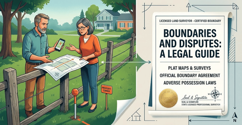
This is where free stops working. A county map, a phone app, and a string between two flags carry no legal authority, and neither does a fence that has stood since 1974. What courts read is a survey signed and sealed by a licensed professional surveyor in your state.
Try the cheap moves first. Show your neighbor the plat, walk the pins together, and offer to split the cost of one survey rather than paying for two that disagree.
- Get the survey before either of you spends money on construction
- Ask the surveyor to set and cap permanent corners, not just paint marks
- Record a written boundary line agreement if you settle it between yourselves
- Check your state’s rules on adverse possession and long-standing fence lines
Some states let a fence in the wrong place harden into a legal boundary after enough years of quiet use. An old fence is worth resolving early rather than ignoring. Once money or a deadline is involved, our guide on when a real estate attorney earns their fee covers what that conversation looks like.
Your Next Step
Open your county assessor’s parcel search tonight and find your parcel number. Order the plat, read the deed, then call 811 and book a Saturday with a metal detector. If the pins come up clean and nobody disputes them, you are done for free. If they do not, you now know exactly what to ask a surveyor for.
Conclusion
Learning how to find your property line for free is easier than many homeowners expect. By combining your county’s GIS parcel viewer, the recorded plat, your deed’s legal description, and any existing survey pins, you can identify your property’s approximate boundaries without paying for a survey. These free resources are ideal for planning landscaping, understanding your lot, or checking whether a fence or tree line appears to cross the boundary.
However, free methods have limits. County maps and phone apps are not legally precise, and they should never be the basis for building a fence, driveway, addition, or settling a dispute with a neighbor. When accuracy matters, or the boundary is contested, a licensed land survey remains the only legally recognized way to establish your property line. Starting with the free steps can save time and money, while also helping you understand exactly what to ask for if a professional survey becomes necessary.
If you want to know about House Foundation Repair Guide then visit our Property Investment category.
Frequently Asked Questions
Almost. The steps above for how to find your property line for free depend on your county publishing parcel and deed records online. A handful of rural counties still make you visit the courthouse. The records exist either way. You may just have to ask a clerk for them in person.
Not reliably. Google Maps does not carry parcel boundaries in most of the country, and where an outline appears, it is licensed county data with the same accuracy problems. Use it for the aerial photo and for measuring distances, then check the shape against your county’s own viewer.
Plan on 5 to 30 feet of drift, depending on how carefully your county digitized its tax maps and how old the source drawings are. Flat, recently platted subdivisions do better. Rural parcels with metes and bounds descriptions do worse.
They may be buried under fill, paved over, or pulled out during utility work. Try the neighbors’ corners, since every pin you find gives you another anchor to measure from. If three corners stay missing, that is a fair signal to pay for a stakeout.
Your city may not require one, but your setback rules still apply, and your neighbor still has standing. A $250 stakeout on a $6,000 fence is the cheapest argument insurance you will ever buy.